Day 1 - Walking St Olav's Way, Norway
Oslo -> Leisund 32km
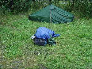
The walk starts in Oslo centre and works its way through the suburbs. I failed to find the start of the trail but it must have been close! It is a good idea to pick up an Oslo city map which is easier to navigate by than the guide book. I got mine from Eivind in the Pilgrim office in Oslo. After a while the trail becomes less urban and there is some nice forest walking on the edge of Oslo. I camped before the villiage of Leirsund.
Day 2 - Walking St Olav's Way, Norway
Leisund -> Hovin Kirke 19.5km (?)
The second day was slightly harder going due to a heavier pack with more food and methelated spirit (called Rodspirit in Norway) which I managed to buy from a petrol station. Distances didn't seem to be accurate in the guidebook (add an extra 4km to each today). I walked from 10am to 7pm the book said I only covered 20km, doh.
I managed to find a good camping spot in the church grounds and settle down for the evening. It had been difficult finding somewhere to camp because everywhere seemed to be cultivated.
Day 3 - Walking St Olav's Way, Norway
Hovin Kirke -> Eidsvoll Kirke 27km
The largest burial bound in Europe is near Hovin Kirke ~15m high and it is possible to climb to the top. This next section takes you past the airport. Again distances seem longer than in the book. There is a section which passes through a barley field with some confusing directions but a friendly lady who owned it came out and pointed me across it! I reached Eidsvoll Kirke after about 12 hours and once again camped out in the church grounds.
Day 4 - Walking St Olav's Way, Norway
Eidsvoll Kirke -> Finnsbraten 24km
Note: it is necessary to buy food for 2 days before leaving Eidsvoll.
I walked into Eidsvoll town and stocked up on food.
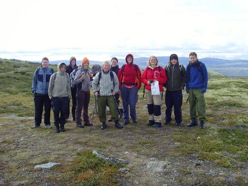
While eating breakfast in a car park a group emerged from a nearby hostel wearing backpacks. Could it be more walkers on the trail?! It turned out to be Eivind Luthen from the pilgrim's office in Oslo leading a group of Norwegians, a Danish guy had also joined them. The group were walking to Finnsbraten near Lysjoen where there was accommodation so I joined their group for a while. It was great to walk with Eivind for a while who was the person who has revived the pilgrim route which had not been walked for hundreds of years! Having things pointed out and getting a deeper look in to the route and Norwegian culture (did you know that the milk can in the village square was a good place to meet girls?).
By this stage the scenery is very pleasant, walking through forests and some lakes around if you fancy a swim/wash.
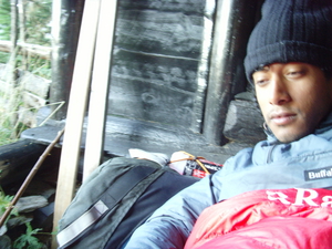
There is a free hut at Lysjoen which it is possible to stay in! It looked very comfortable.
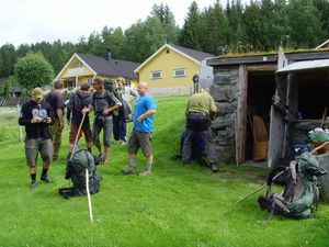
At last some company! Taking a break at a pilgrim shelter along the way.
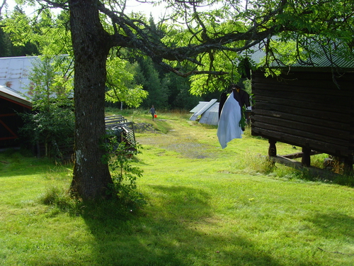
The accommodation at Finnsbraten had beds and a stove. After finding the shower (a very cold water pump down the hill (!) there was a chance to do some laundry and hang it on a tree.
Day 5 - Walking St Olav's Way, Norway
Finnsbraten -> Hetnes nordre gard 16km
Beautiful forest walking and views of lake Mjosa. Stayed with the Norwegian group in the stabbur at Hetnes. Near Hetnes there is an Esso petrol station which is famous for selling the most bolle (round chocolate buns). Apparently they sell 1.1 million a year.
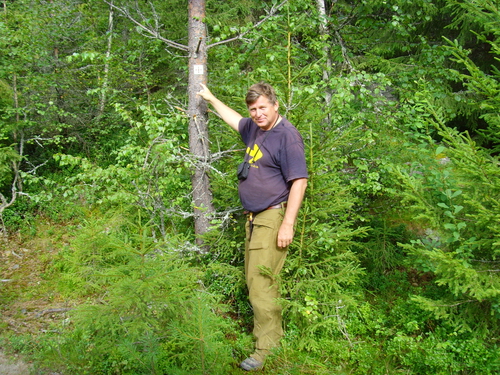
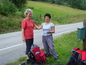
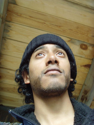
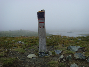
I was very proud to put up my very own St Olav's waymark - pictured here with Eivind.
Day 6 - Walking St Olav's Way, Norway
Hetnes nordre gard -> Stange Kirke 24km
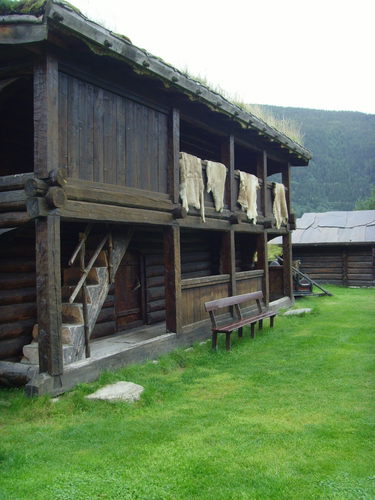
A relatively short day. Good views of the lake/forest. Stayed in a very nice stabbur with the group about 1.2km away slightly off the track.
Day 7 - Walking St Olav's Way, Norway
Stange Kirke -> Hamar 12km
First large town on the way. There is a youth hostel opposite the ice skating stadium (which you can visit - but expensive 30kr). Apparently there is a campsite.
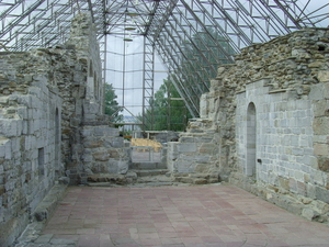
Hamar has a famous 'glass cathedral'. It is on the way out of town on the pilgrimsleden and is definitely worth a visit. I went with the Norwegian group who had a tour/talk by a lady in traditional dress who also played traditional music on a recorder.
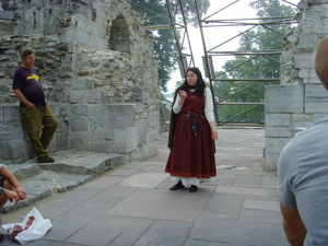
The glass cathedral at Hamar
Day 8 - Walking St Olav's Way, Norway
Hamar -> Veldre Kirke 27km
I stayed in accommodation near Veldre Kirke where it is suitable for larger groups.
Day 9 - Walking St Olav's Way, Norway
Veldre Kirke -> Lillehammer 45km
After Veldre Kirke I left the Norwegian group and decided to walk a longer day to the next large town of Lillehammer, host of the 1994 Winter Olympics!
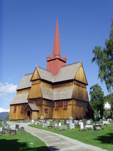
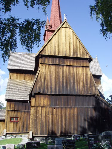
The route passes Ringsaker Kirke shortly after Veldre Kirke. It is one of the older wooden churches and is worth a look inside. The church contains a very ornate alter box and a statue of St. James the pilgrim, who will be familiar to those who have walked the Camino de Santiago.
The church is sometimes locked (and was when I was there). It may be necessary to find someone to open it. The very helpful gardener let me in, gave me an information sheet and opened the altar piece to show to carvings.
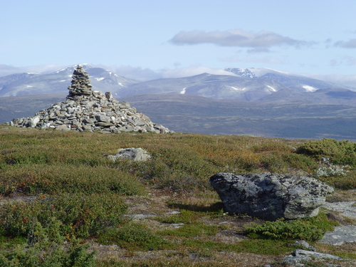
Things of note on the way: Standing stones at Tolvsteinsringen, apparently a camp site near Brottum church (I believe this is slightly off the way), Olavskilde a spring (wasn't very spring like when I was there...a more impressive and drinkable one just after Dovre village).
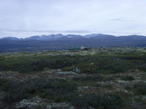
Again some very nice views of lake Mjosa and long forest roads before reaching Lillehammer.
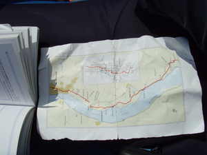
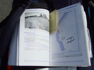
(Above) A map I managed to pinch and some helpful additions to my book from Eivind (showing the campsite at Brottum)
Day 10 - Walking St Olav's Way, Norway
Lillehammer -> Just before Kjorkehaugen 31km
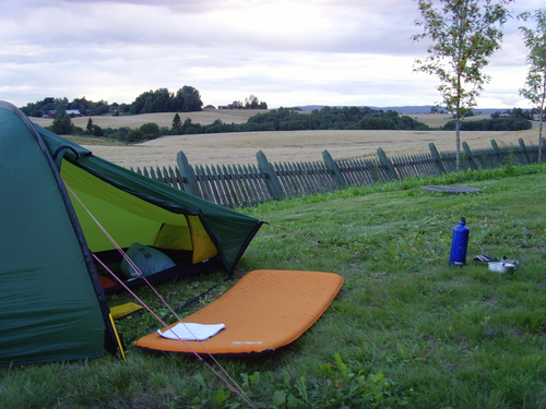
I believe it is possible to stay at Skaden Gard before where I camped for the night. I was actually finding it quite difficult to find a place to camp around here (lots of pine forest/land looking like it belongs to people). I ended up on a patch of grass just off the road. It would have been fine but the farmers were bringing in the harvest so there was heavy tractor traffic until the early hours of the morning.
The path climbs slightly after Lillehammer giving some views back over lake Mjosa and the next valley.
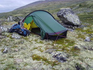
Making do for the evening (that's the road behind the trees)
Day 11 - Walking St Olav's Way, Norway
Just before Kjorkehaugen -> Ringbu Stavkirke 31.5km
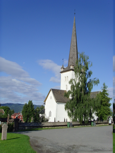
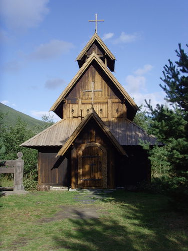
Passing Rollabru bridge and Favang (shops) and reached Ringbu Stavkirke (the only stave church on the pilgrimsleden). Stayed in Gildevollen, quite inexpensive accommodation but very comfortable. Was able to wash some of my kit and cook some dinner on a cooker. I had called ahead and the owner had left the key for me.
The stavkirke is well worth a visit, the staff in traditional dress are very friendly and will give you a tour if you ask them. If you are doing St. Olav's way you can visit the church for free. Apparently the original building dates back to the early 12th Century - from what I understood some of the wood is from that time (!).
Day 12 - Walking St Olav's Way, Norway
Ringbu Stavkirke -> Gapahuk, just after Skar 28km
There is an octagonal church on the way.
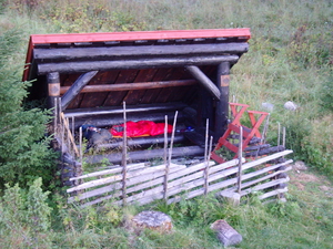
A gapahuk is a three walled shelter on the mountain...if you have a sleeping bag and some warm clothes one of the nicest places to sleep. It is just a short walk after Skar. There is another Gapahuk on the way just after Oppdal, although I didn't stay there).
Day 13 - Walking St Olav's Way, Norway
Gapahuk just after Skar -> Kvam 19.5km
There is a campsite in Kvam where it is also possible to sleep in your own hut (200kr).
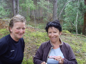
On the way I met the only two other walkers I would meet on the way – Agnes and Isolde from Paris! They had taken the western route (I understand this is no longer maintained) and had a hard time with signposts and overgrown paths but look none the worse for wear and still very cheerful!
Day 14 - Walking St Olav's Way, Norway
Kvam -> Varphaugen 11km
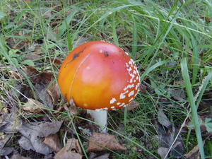
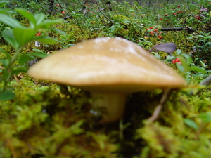
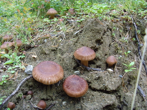
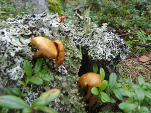
A short day's walk. Many mushrooms along this section! A difficult rocky section, keep a good eye out so you don't loose the way, after a couple of hundred metres it becomes a clear path.
Agnes and Isolde stayed in a hut which was inexpensive but I camped in my tent for 50kr. The guy there chatted to me and showed me some rocks old pilgrims had left in the 15th century and and old well (now a hole in the ground). I was also allowed to use the sauna with an old fashioned wood fire stove.
Day 15 - Walking St Olav's Way, Norway
Varphaugen -> Jorundgard Mittlealtersenter 24km
There is a view point with cross shortly after Varphaugen. I went up to see spring at next part but couldn't find path and ended up in someone's garden. Clambered over their roof climbing down from the gate to the driveway, checked for dog then ran off!
Took the cycle track to Otta (medium sized town, cash point, shops).
Stayed in Jorundgard Mittlealtersenter, a film set reconstructed as a 12th century Farm, complete with stave church. You can sleep on mediaeval beds with animal skins, there is no electricity or heating except in a kitchen where you can cook (may take a while to look for it, best not to arrive after dark). Phone ahead for keys and info on how to get in to the kitchen...
Day 16 - Walking St Olav's Way, Norway
Jorundgard Mittlealtersenter -> Budsjord 28km
Note: It is necessary to buy food for 3-4 days before leaving Dovre as the next section is across the mountains.
Passing through Dovre, The only wood carving school in Norway is here I would have visited it if I knew beforehand: http://www.hjerleid.no/
Accommodation available at Budsjord. No space left when I was there but the lady let me stay in the gapahuk for 50kr.
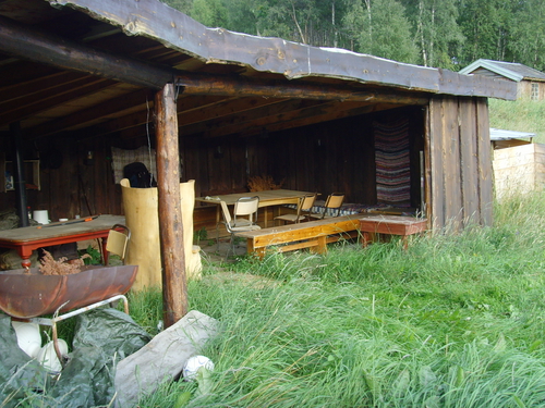
Gapahuk at Budsjord........
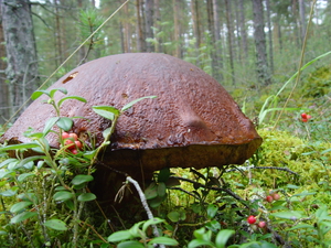
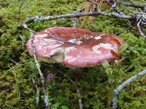
(Why should the mushrooms get all the attention?)
Day 17 - Walking St Olav's Way, Norway
Budsjord -> before Furuhaugli ~16km
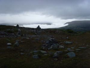
Well worth the walk to reach Dovre Fjell, stunning mountains. Noticeably colder but was luck with the weather.
Allmannroysa view point where there is a guestbook, leave your stone here if you brought one. Met the woodcarving school here who were out for a walk!The path was clear but there was still snow/ice on around some sections of the river. Fokstufu – Norway's highest farm is on the way, bird sanctuary behind it, although I didn't visit (takes ~3 hours to visit). Camped on mountain, great views.
Allmannroysa and the woodcarving school.....!
It was great to finally be above tree line with great views of the mountains.......
and a good place to pitch for the night.
Day 18 - Walking St Olav's Way, Norway
Before Furuhaugli -> Hjerkinnho (1200m) ~20km
Burial mounds. Quite boggy ground (a stick may come in handy, especially when on wobbly boards).
Camped on mountain again, Hjerkinnho.
Day 19 - Walking St Olav's Way, Norway
Hjerkinnho (1200m) -> Rypusan 29.5km
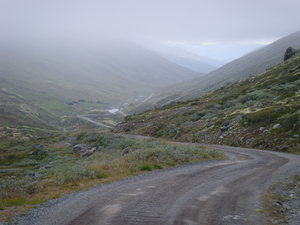
Note: I was advised by Eivind to walk along the road from Joroskloppa to Kongsvold. I had a high visibility vest which I pined to my backpack/wore for road walking.
Very nice pilgrim shelter at Rypusan, unattended. Need to get water from the stream (there is bucket!). Gas stove. Toilets out back(!).
On the way to Rypusan........and a Bed!
Day 20 - Walking St Olav's Way, Norway
Rypusan -> Bjerke Gard ~32km
The footpath continues through mountains which climbs until view of Oppdal then drops in to the valley past farms and towards the E6.(not the same place as in the guide – about 500m up towards Oppdal). Took the alternate route towards Oppdal which has quite back roads through forest. Large set of burial mounds before Oppdal.
Oppdal is a large town (especially after Dovre) and has many shops .
The youth hostel in the guide book does not exist anymore and is now an expensive hotel.
I stayed at Bjerke Gard run by Froydis and Erik Bjerke, possibly the friendliest place you will find.
Day 21 - Walking St Olav's Way, Norway
Bjerke Gard -> Just after Orkla ~30km
There is a woodcarving exhibition just after Bjerke Gard.
Later in the day the pilgimsleden joined with a forest road which I decided to stay on until Orkla (as the official footpath seemed to be taking some detours). Camped in field just after Orkla.
Day 22 - Walking St Olav's Way, Norway
Just after Orkla -> Olskastet 37km
If you decided to take the 'short-cut' over the hill between Stamnan and not follow the road then pay close attention to the path. What happened next involved a rather steep forested cliff, tossing my pack down and watching it fall all the way to the bottom. I tried to climb down after it and landed in a nettle forest :(
This was the only day that I got really wet as it rained hard in the morning.
The path follows a wide track road through forest and farms to Meldal. Olskastet a few km after is an old fashioned hut which is free to stay in. Basic, no electricity, need sleeping bag. There is a spring nearby but it didn't look drinkable.
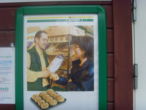
Joker!..... I found this very funny.
Day 23 - Walking St Olav's Way, Norway
Olskastet -> Skaun Kirke
Shortly after Olskastet is Lokken Verk mines and railway (which you can visit). Supermarket.
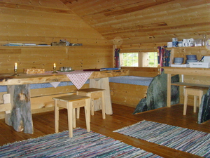
In the next section I took a very different route to the pilgrimsleden and ended up in the next valley. I wouldn't recommend this. A very long day and was planning on sleeping outside Skaun Kirke but decided to ring on the off chance the accommodation was open. The lady on the phone was very friendly and someone was over very quickly to open the place just across the road from the chuch. 125Kr, much needed camp bed! Also has cooking facilities.
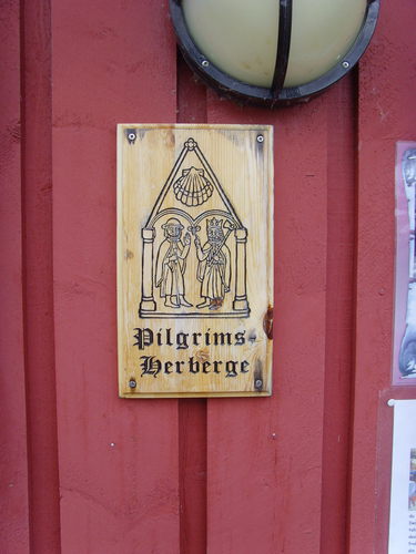
A very welcoming sign opposite Skaun Kirke.
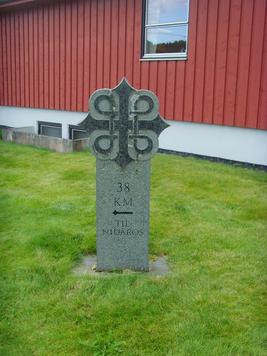
Only 38km left....!
Day 24 - Walking St Olav's Way, Norway
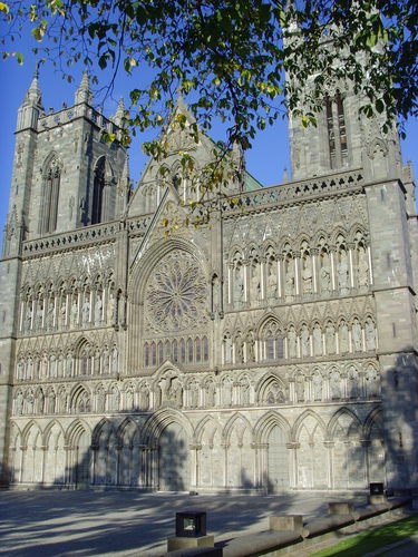
Skaun Kirke -> Trondheim 38km
After Oysand camping the route is not waymarked and I had some trouble finding the way. You can either continue straight on and get the boat across the river to Sundet (the traditional way). But I took the road east and crossed by the bridge.
The path in to Trondheim is rather confusing and I lost it several times and had to ask for directions. I would probably take a more detailed map of the area.
It is possible to stay in the pilgrims gard near the Cathedral. There are also other youth hostels around the city.
The next day I managed to sneak on an english language tour of the Cathedral which was very interesting and the tour guides are very helpful!